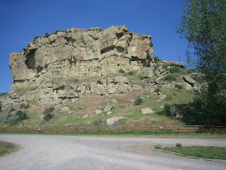
The Lewis and Clark Expedition set out for adventure in 1804 with the blessings of President Jefferson to explore the new Louisiana Purchase. Their mission: to chart a water path to the Pacific Ocean by heading UP the Mississippi and Missouri Rivers, head west then UP and OVER the Rockie Mountains. Document and chart every new specie of plant, animal and Native Indian tribe along the way. The Journey took two years and not a single man was lost. It's an impressive story. This particular area of the Yellowstone is where Clark came ashore and carved his name in the mountain.
Below is a picture overlooking Billings, Montana.

The Yellowstone River where William Clark and some of his crew paddle through and possibly landed.

A dugout boat, the type that members of the Lewis and Clark Expediton would have made

Standing on a mountain top of Pompey's Point overlooking the Yellowstone River
 Another view of the Yellowstone River
Looking west on the Yellowstone

William Clark carved his name in the mountain. Wm Clark was here :) It wasn't discovered until the 1870''s when the railroad was coming through.

Wm Clark 1806


No comments:
Post a Comment